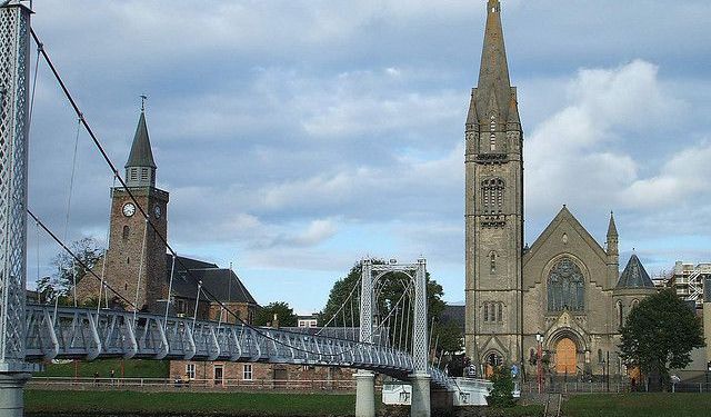
Caledonian Canal, Inverness
The Caledonian Canal, an engineering marvel of the early 19th century, stretches 60 miles (100 kilometers) across the stunning Scottish Highlands, linking the east coast at Inverness to the west coast at Corpach, near Fort William. Designed by renowned Scottish civil engineer Thomas Telford, the canal was completed in 1822 after nearly two decades of construction. Initially conceived to mitigate the perilous maritime route around Scotland’s rugged coastline, the canal now offers a tranquil and scenic journey through the Great Glen, a geological fault running across the Highlands.
Of its total length, only 22 miles are man-made, with the remaining 38 miles formed by four interconnected lochs: Loch Dochfour, Loch Ness, Loch Oich, and Loch Lochy. The canal rises to an impressive 106 feet (32 meters) above sea level, facilitated by 29 locks, including the famous Neptune's Staircase-a series of eight locks near Fort William that elevate vessels by 70 feet throughout 500 yards. This intricate ladder of locks is one of the canal's most remarkable sights and a testament to the ingenuity of its design.
Visitors can explore the canal in numerous ways, whether by sailing, cycling, walking, or even fishing along its serene towpaths. Key points of interest include the Muirtown Locks near Inverness, the Fort Augustus Locks, which connect to the iconic Loch Ness, and Neptune's Staircase at Corpach, offering breathtaking views of Ben Nevis.
Whether you’re seeking a leisurely afternoon by the water or a deeper dive into its history at the Caledonian Canal Heritage Centre in Fort Augustus, this waterway offers a unique blend of natural beauty, historic intrigue, and engineering brilliance. For those craving an adventure, the Great Glen Way follows the canal’s route, offering a 73-mile journey from Fort William to Inverness through some of Scotland’s most breathtaking landscapes.
Want to visit this sight? Check out these Self-Guided Walking Tours in Inverness. Alternatively, you can download the mobile app "GPSmyCity: Walks in 1K+ Cities" from Apple App Store or Google Play Store. The app turns your mobile device to a personal tour guide and it works offline, so no data plan is needed when traveling abroad.
Caledonian Canal on Map
Sight Name: Caledonian Canal
Sight Location: Inverness, Scotland (See walking tours in Inverness)
Sight Type: Attraction/Landmark
Sight Location: Inverness, Scotland (See walking tours in Inverness)
Sight Type: Attraction/Landmark
Walking Tours in Inverness, Scotland
Create Your Own Walk in Inverness
Creating your own self-guided walk in Inverness is easy and fun. Choose the city attractions that you want to see and a walk route map will be created just for you. You can even set your hotel as the start point of the walk.
Inverness Historical Buildings Walking Tour
Inverness, a city established in the 12th century, boasts an array of historical architecture reflecting its rich and often tumultuous past. Many of its centuries-old buildings are situated along the banks of the River Ness and blend effortlessly with the surrounding landscape.
Undoubtedly, prime among these is the Inverness Castle, perched majestically atop a hill overlooking the city.... view more
Tour Duration: 2 Hour(s)
Travel Distance: 2.0 Km or 1.2 Miles
Undoubtedly, prime among these is the Inverness Castle, perched majestically atop a hill overlooking the city.... view more
Tour Duration: 2 Hour(s)
Travel Distance: 2.0 Km or 1.2 Miles
Inverness Introduction Walking Tour
Often regarded as the Capital of the Scottish Highlands, Inverness is steeped in history and legend. The name "Inverness" derives from the Scottish Gaelic "Inbhir Nis," which means "mouth of the River Ness," a fitting moniker for a city that thrives along the banks of this scenic waterway.
The Inverness area has been inhabited since 6500 BC, once being a... view more
Tour Duration: 2 Hour(s)
Travel Distance: 2.3 Km or 1.4 Miles
The Inverness area has been inhabited since 6500 BC, once being a... view more
Tour Duration: 2 Hour(s)
Travel Distance: 2.3 Km or 1.4 Miles


