
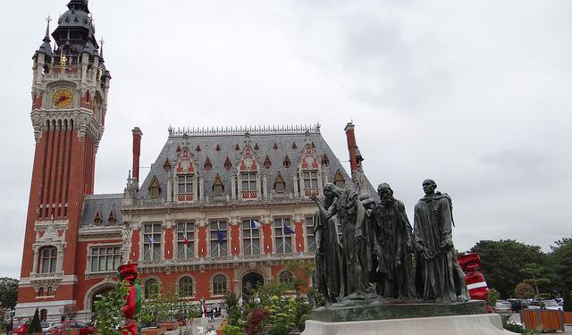
Citadelle de Calais (Citadel of Calais), Calais
The Citadel of Calais, a historic fortress in Calais, embodies centuries of military significance and architectural evolution. Originally constructed on the site of a 13th-century medieval castle, this imposing stronghold was built in the 16th century following France’s recovery of Calais from England in 1558. King François II initiated the construction of the citadel to reinforce Calais's defenses, prioritizing its strategic location near the Spanish Netherlands and England. To make way for the new fortress, an entire neighborhood, including the Saint Nicholas Church and several English-owned hotels, was dismantled.
The citadel’s first stone was laid in 1564, symbolizing England’s formal recognition of Calais as French territory, facilitated by a substantial payment to Queen Elizabeth I. Designed by Italian engineer Giacomo Castriotto and Jean Errard, the new fortress incorporated state-of-the-art fortifications, such as Neptune's Gate—a distinctive half-moon entrance. Remnants of the medieval city walls, like the Carrée and Pavée Towers, remain to this day, offering a glimpse into its storied past.
The Citadel of Calais soon found itself in the crossfire of European conflicts. In 1596, the Spanish forces, led by Archduke Albert VII, besieged Calais, breaching the citadel despite fierce resistance. Calais fell temporarily under Spanish control until the Treaty of Vervins in 1598 restored it to France. The citadel then served as the residence of French governors, who were entrusted with its upkeep due to its critical location.
In the 1600s, a new Saint Nicholas Church was built within the citadel’s ramparts, which saw various community events until it was repurposed during the French Revolution. The citadel’s fortifications were later expanded under Henri IV, and by the 19th century, it accommodated over 1,000 troops, equipped with stables, powder magazines, and storage facilities. Notably, Claude Chappe conducted semaphore telegraph tests here before relocating to the Tour du Guet.
Listed as a historic monument in 1939 and again in 1990, the Citadel of Calais has withstood centuries of change. In the 1960s, it was converted into a sports complex known as Stade du Souvenir, hosting fields for football, rugby, tennis courts, and other athletic facilities. Today, the citadel serves as a reminder of Calais's turbulent history and evolving purpose over time, transitioning from a medieval stronghold to a modern community venue.
Want to visit this sight? Check out these Self-Guided Walking Tours in Calais. Alternatively, you can download the mobile app "GPSmyCity: Walks in 1K+ Cities" from Apple App Store or Google Play Store. The app turns your mobile device to a personal tour guide and it works offline, so no data plan is needed when traveling abroad.
Download The GPSmyCity App
Citadelle de Calais (Citadel of Calais) on Map


Sight Name: Citadelle de Calais (Citadel of Calais)
Sight Location: Calais, France (See walking tours in Calais)
Sight Type: Attraction/Landmark
Sight Location: Calais, France (See walking tours in Calais)
Sight Type: Attraction/Landmark
Walking Tours in Calais, France

Create Your Own Walk in Calais
Creating your own self-guided walk in Calais is easy and fun. Choose the city attractions that you want to see and a walk route map will be created just for you. You can even set your hotel as the start point of the walk.
Calais Introduction Walking Tour
Calais, a French port city, strategically overlooks the Strait of Dover at the English Channel's narrowest point, merely 34 km (21 miles). On a sunny day, one can clearly see the White Cliffs of Dover on the English side. A major ferry port between France and England, Calais also has been connected directly to the UK by rail, through the Channel Tunnel, since 1994.
The name Calais, tracing... view more
Tour Duration: 2 Hour(s)
Travel Distance: 3.0 Km or 1.9 Miles
The name Calais, tracing... view more
Tour Duration: 2 Hour(s)
Travel Distance: 3.0 Km or 1.9 Miles