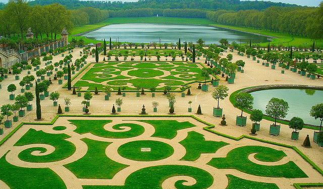
Grand Canal, Versailles
If you are very rich or very powerful, you can obtain almost anything; Louis 14th, who was both, had no trouble indulging his every whim when it came to beautifying Versailles and one of his whims was the Grand Canal.
This artificial lake was laid out by André le Notre between 1668 and 1679. It is 1670 metres long and 62 metres wide, running in an east to west direction. It wasn’t only for the king’s pleasure, because it served a practical role too. As it lies on land lower than most of the garden’s fountains, water drains from them into the lake.
This extra water was pumped by windmills and horse powered pumps to a reservoir situated on the roof of the Grotte de Thétys and from there it fed the fountains of the gardens below the grotto.
Water was a very precious commodity at Versailles, seeing that it was situated 10 kilometres from and 150 metres above the River Seine. It was brought from the river to the Louveciennes Aqueduct by the “Machine de Marly” - a system of 14 huge water-wheels that operated 177 pumps. It was planned by Rennequin Sualem and built by Arnold de Ville.
The canal was used for nautical displays and boats were sailed on it. The Republic of Venice gave the king two gondolas and four gondoliers, who were housed in lodgings called “Petit Venice”. The king’s “boatyard” also consisted of several long-boats, a galley, a three-master, a brigantine and two yachts.
Want to visit this sight? Check out these Self-Guided Walking Tours in Versailles. Alternatively, you can download the mobile app "GPSmyCity: Walks in 1K+ Cities" from Apple App Store or Google Play Store. The app turns your mobile device to a personal tour guide and it works offline, so no data plan is needed when traveling abroad.
Grand Canal on Map
Sight Name: Grand Canal
Sight Location: Versailles, France (See walking tours in Versailles)
Sight Type: Attraction/Landmark
Sight Location: Versailles, France (See walking tours in Versailles)
Sight Type: Attraction/Landmark
Walking Tours in Versailles, France
Create Your Own Walk in Versailles
Creating your own self-guided walk in Versailles is easy and fun. Choose the city attractions that you want to see and a walk route map will be created just for you. You can even set your hotel as the start point of the walk.
Versailles Introduction Walking Tour
Versailles, a wealthy suburb of Paris some 20 kilometers southwest of the capital, is steeped in grandeur and regal history. Known worldwide for its opulent palace – the residence of French royalty, this small town offers much more than just its royal gates. Versailles is a living museum of French architecture and aristocratic life and is historically known for numerous treaties signed there,... view more
Tour Duration: 2 Hour(s)
Travel Distance: 3.5 Km or 2.2 Miles
Tour Duration: 2 Hour(s)
Travel Distance: 3.5 Km or 2.2 Miles
Versailles Gardens Walking Tour
Spread across a vast (800-hectare) area, the Versailles Gardens are the quintessential example of regal grandeur and meticulous French landscape design. Most of its feature areas – known as 'groves' – were created by King Louis XIV’s chief landscape architect André Le Nôtre. Key among the garden's numerous attractions is the Orangerie Fountain, which sets the tone for its... view more
Tour Duration: 3 Hour(s)
Travel Distance: 3.5 Km or 2.2 Miles
Tour Duration: 3 Hour(s)
Travel Distance: 3.5 Km or 2.2 Miles


